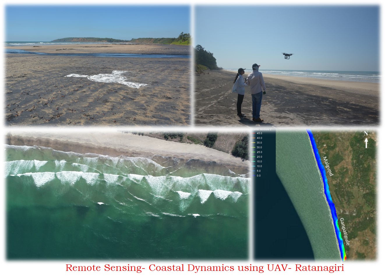
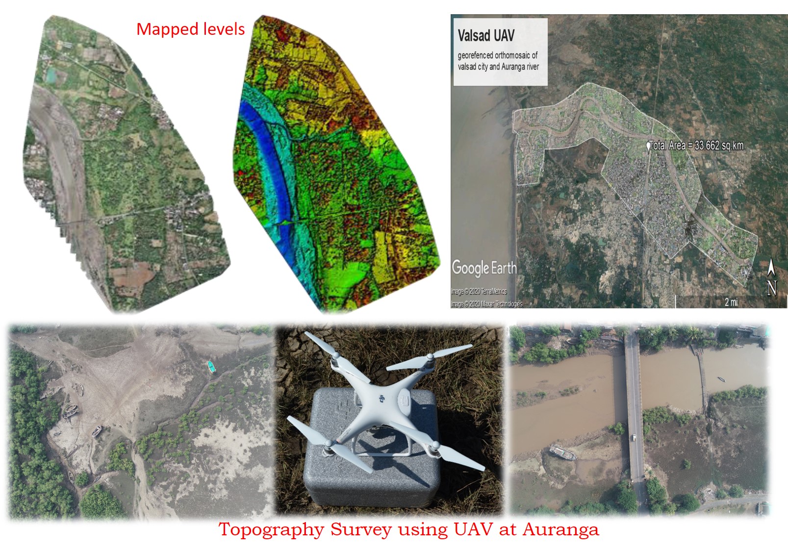
Remote Sensing Application in Coastal Engineering
It is inevitable to use of Remote Sensing technologies in the research studies of coastal/ocean engineering sciences.
The application of satellite imagery based analysis ranging from,
- Analysing long-term shoreline positions
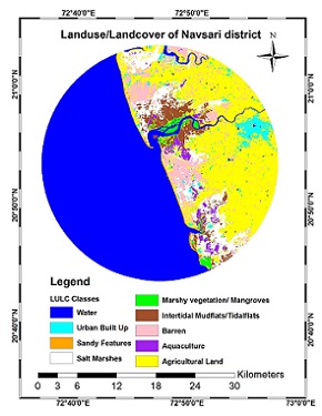
- Influence of Land-Use & Land-Cover (LULC) on the shoreline oscillations
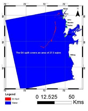
- Assessment of trajectories of oil spill & area of spread
- Estimation of nearshore bathymetry
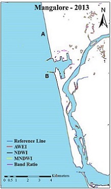
- Automated shoreline detections
- Estimation of physical oceanographic parameters, such as sea-surface temperature, salinity, chlorpyll etc.
- Estimation of temporally & spatially varying suspended sediment concentrations.
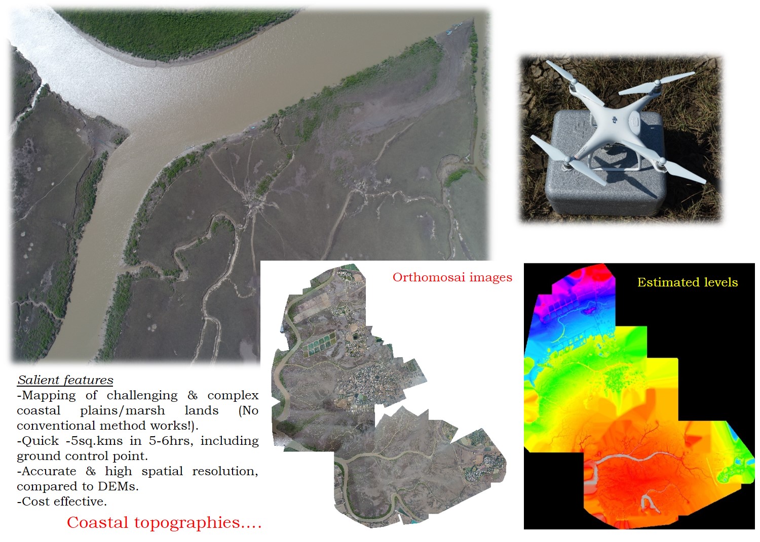
- UAV based estimation of coastal topographies.
Some of the satellite imageries based analysis have been validated with available and our own field measurements.
| Remote Sensing Studies | Available Tools |
|---|---|
| Shoreline change & Land use/cover change Oil-spill mapping Automated shoreline mapping Nearshore Bathymetry |
ArcGIS ERDAS IMAGINE QGIS |