1
Equipment
Unmanned Surface Vehicle
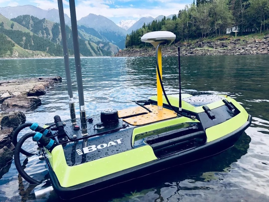
Description HydroBoat 1100, Unmanned Surface Vehicle (USV) by Satlab Geosolutions:
An Android-powered USV, streamlines bathymetric surveys with a single operator, one boat, and a user-friendly controller.
With easy-to-use android software and an integrated and practical boat structure, the HydroBoat 1100 sails fast and measures accurately with excellent technical performance. It has the functionality of conducting pre-planned survey.
It comes with built-in SLHydro single beam 200 kHz Echosounder provides autonomous, easy to use, integrated and safe bathymetric surveys for glacial lakes, rivers in the Himalayan region as well as in plains.
With built in GNSS reciever, it provides precise information of its location of operation and also enables it to make an autonomous return to base in case of communication failure. It has 10 hours of long battery life.
It eliminates the need of signal repeater stations by having a remote-control transmission range of 2 Km and providing a live video feed.
2
Equipment
Kayak based Hydrographic Survey System
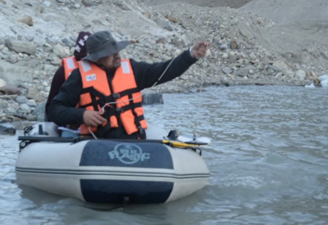
Description Inflatable kayak-mounted bathymetric mapping system is a simple and easy-to-use system used to create bottom terrain maps of lakes, rivers. It consists of a portable Airmar P66 echosounder and Simrad assembly mounted on an inflatable Sea Eagle 380x Explorer kayak. The overall cost of the entire setup is 155,000 INR including the cost of echosounder assembly. It consists of
(i) single-beam transom-mounted Airmar P66 transducer and
(ii) Simrad SONAR GO5 XSE display unit with a built-in high-speed 10 Hz Global Positioning System (GPS) receiver, which updates the position ten times every second and provides latitude and longitude with a positional accuracy of 3 m (refer to
www.simrad-yachting.com) It is capable of operating at two frequencies i.e. 50 kHz and 200 kHz. The choice of the operating frequency depends upon the depth of the lake i.e. lower the depth higher is the desired frequency and vice versa.
3
Equipment
Drones: SenseFly eBee X(Fixed Wing)
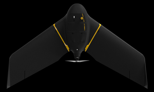
Description The leader in lightweight fixed-wing drones, which automates complex terrestrial surveying methods and enables professionals to act on valuable data insights while boosting their efficiency and safety. Designed to provide absolute accuracy –down to 1.5 cm (0.6 in) with available RTK/PPK– and to cover an area up to 500 ha (1,235 ac) to meet the highest standards of various industries.
1. Agriculture
2. Surveying and Mapping
3. Engineering and Construction
4. Environmental Monitoring
5. Mining, Quarries
We have (i) SenseFly S.O.D.A (first photogrammetry RGB camera to be built for professional drone use) and (ii) Parrot Sequoia multispectral camera featuring 4 bands viz., green, red, red edge and near infrared bands
4
Equipment
Drones: DGI Drones (Quadcopters)
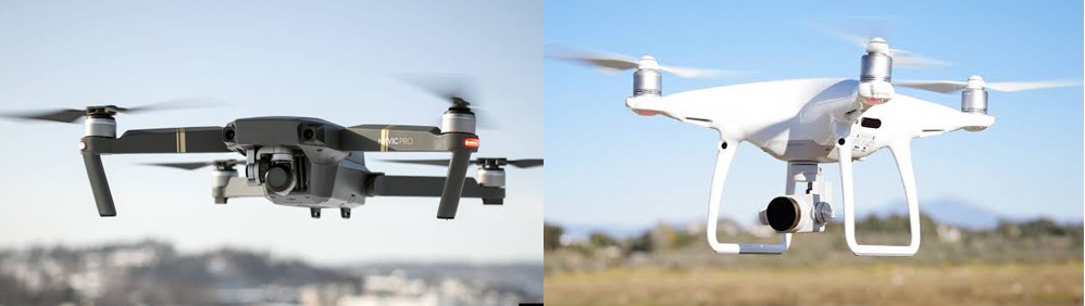
DescrptionWe have one each DJI Mavic Pro and DJI Phantom 4 Pro.
The DJI Mavic Pro is a portable and powerful drone with a 3-axis gimbal 4K camera, a max transmission range of 4.1 mi (7 km), and a sophisticated design.
DJI Phantom 4 Pro is an entry-level professional quadcopter drone with powerful obstacle avoidance. The Phantom 4 Pro camera is equipped with a 1-inch 20-megapixel sensor and has a manually adjustable aperture from F2.8 to F11. It also supports auto focus by half-pressing the shutter button, and has a focus range, from 1m to infinity. It is also loaded with RGB camera, GNSS receiver and IMU unit.
5
Equipment
GSSI SIR 3000 - Ground-penetrating radar (GPR)
Descrption GPR is a geophysical instrument that uses radar pulses to image the subsurface. We have GSSI SIR 3000 model, which GPR control unit with in-built rugged display. This high-performance radar system provides unrivaled data quality. This is small, portable and designed for single-user operation. It is compatible with all GSSI antennas, making it an affordable option for all GPR applications.
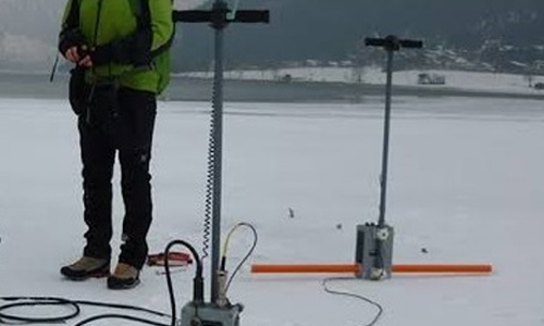
We have variety of antennas ranging from 400 MHz, 200 Mhz (both are monostatic antenna) and multiple low frequency (MLF) bistatic antenna operating at frequency ranges from 16 to 80 MHz. The MLF antenna helps to identify subsurface features more than 100m, typically used for glacier bottom topography mapping.
6
Equipment
Leica C10 - TLS
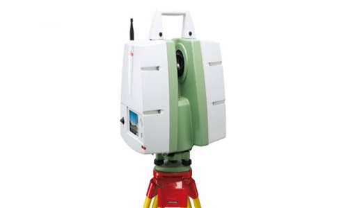
Descrption Terrestrial laser scanners (TLS) are contact-free measuring devices which can collect dense point-clouds of objects. These are very beneficial properties, and laser is thus increasingly used as the principle component in distance measurement devices able to create 3D models of objects of a wide range of sizes and shapes.
The C10 is optimized for short range (<200 m), high speed, high accuracy scanning. It has several unique features compared to other instruments in our pool including a green (532 nm) laser, full overhead scanning, and lightweight internal batteries.
7
Equipment
Trimble GNSS Receivers
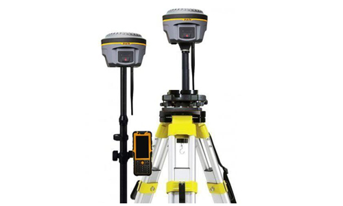
Descrption Global Navigation Satellite System (GNSS) refers to a constellation of satellites providing signals from space that transmit positioning and timing data to GNSS receivers. The receivers then use this data to determine location. We have variety of Trimble GNSS receivers suited for different tasks. Some of them are
Trimble R4- Dual frequency survey grade GNSS Receiver
Trimble Geo XH series receiver with external antenna for surveying and mapping